 |
|
CURRENT
RESEARCH |
|
VISITORS
& VOLUNTEERS |
| Co-Directors of the research project are Cheryl Ann Munson of Indiana Univeristy - Bloomington and Dr. Robert G. McCullough of IPFW. The project has received the generous support of: the landowner; professional archaeologists at many institutions in Indiana and Kentucky; the Falls of the Ohio Archaeological Society; regional historical organizations; and volunteers. |
|
|
|
Questions
or Comments?
|
|
Last
Updated 2.07.2004
|


July
2003 Auger Sample Work
Click on any picture for a larger
version
The site
was established and three permanent datums were set in concrete near fence
lines. About 95% of the topographic mapping was completed and a preliminary
map produced. Topographic mapping covered an area of about 14.0 ha or
34.6 acres, which extends beyond the reported site area of about 30 acres
to show natural and modern features including springs, buildings, fences,
and roads.
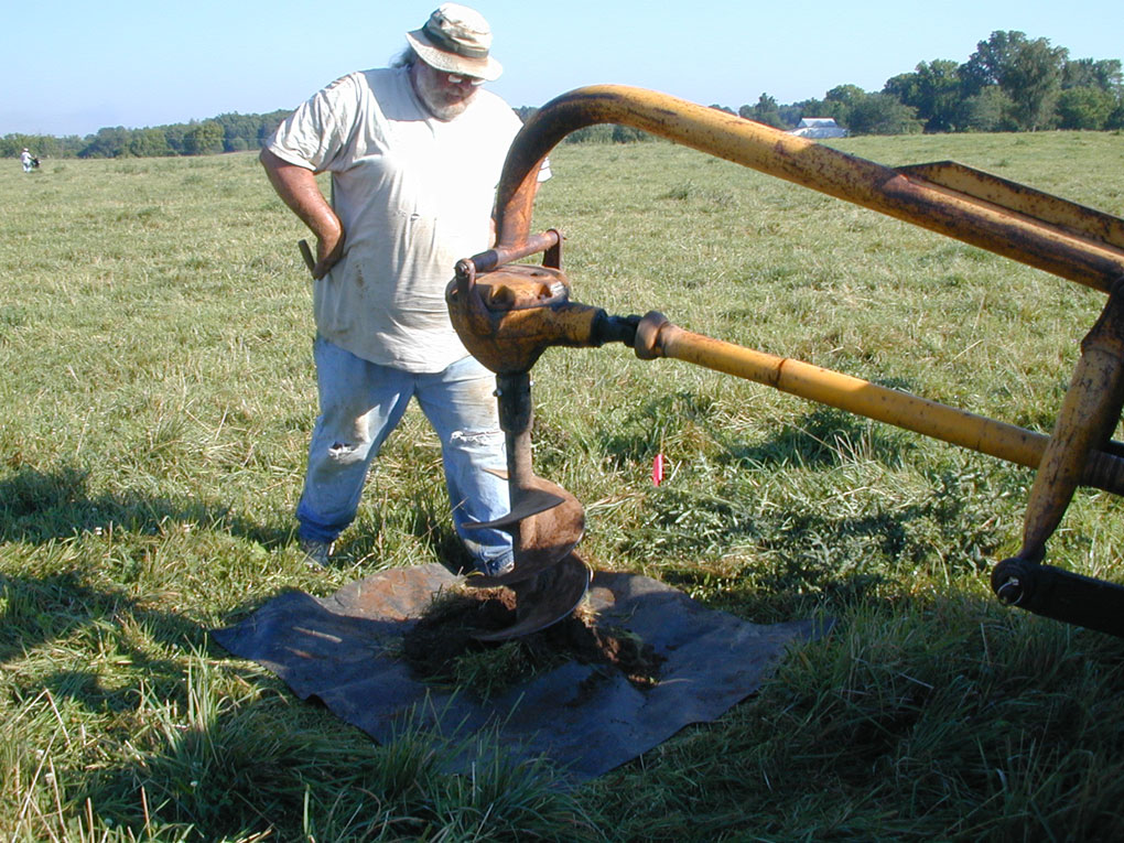
Tractor mounted auguring, with loose soil collecting on rubber mat.
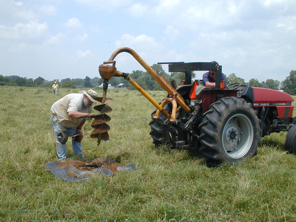
Bob McCullough scrapes off soil adhering to the auger.
Site owner Harold Martin was part of the research team and ran the tractor.
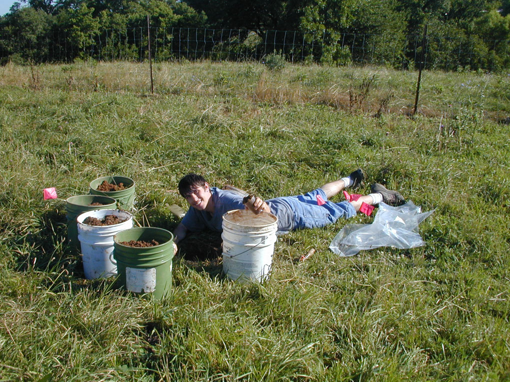
To identify the extent, types, and densities of Mississippian materials
within a large multi-component site, initial auger sampling was carried
out in 20- m intervals in north/south and east/west transects across the
approximate center of the site. A tractor mounted 12-inch auger (30 cm
diameter) was used to mechanically excavate soils at the selected locations
The loosened soils were removed from the auger hole and the immediate
area and collected by shovel and hand tools, and stockpiled or bucketed
for screening through ¼-inch mesh.
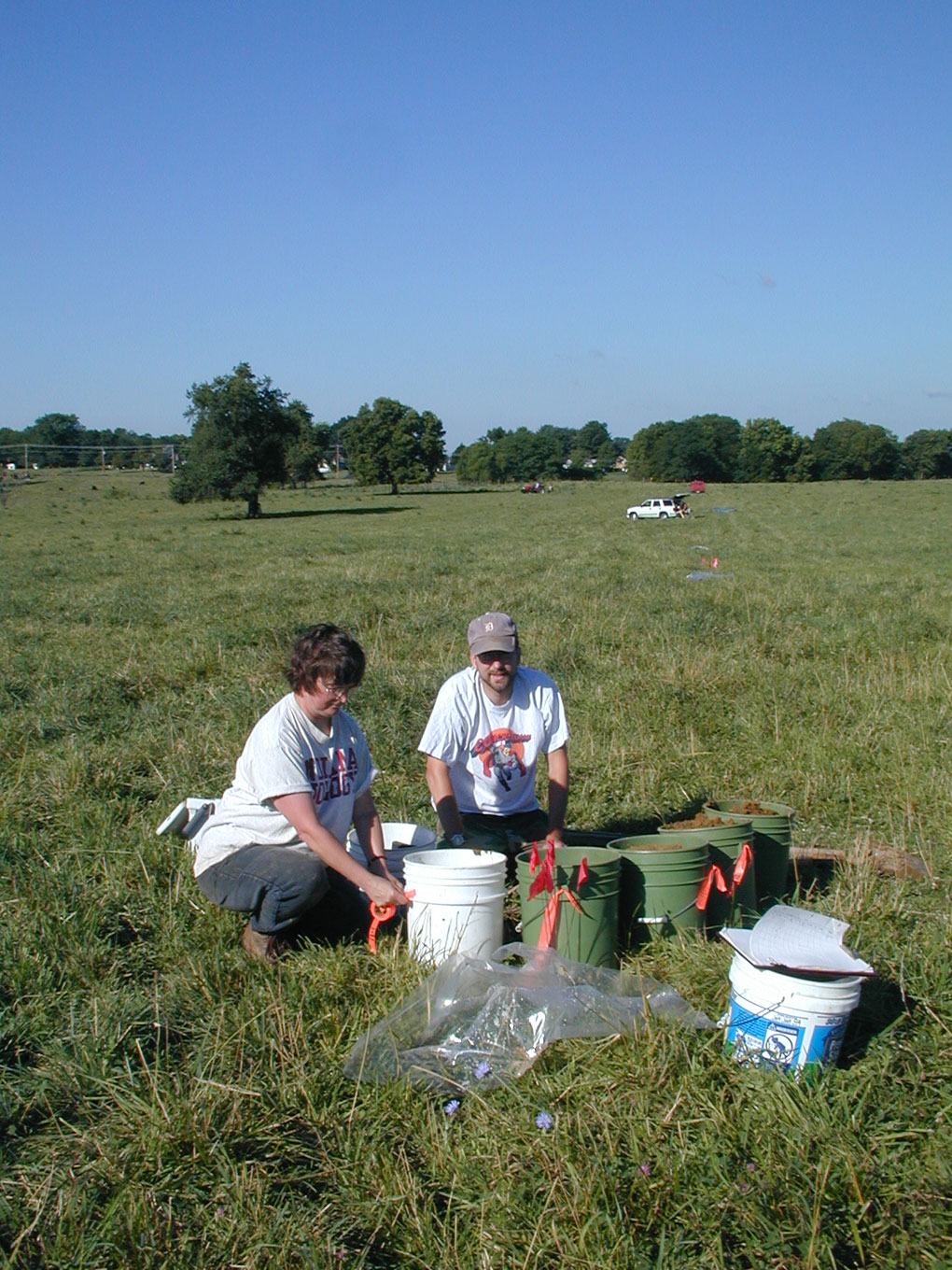
Jocelyn Turner and Mike Strezewski tag buckets and
fill out record forms at one of the auger holes.
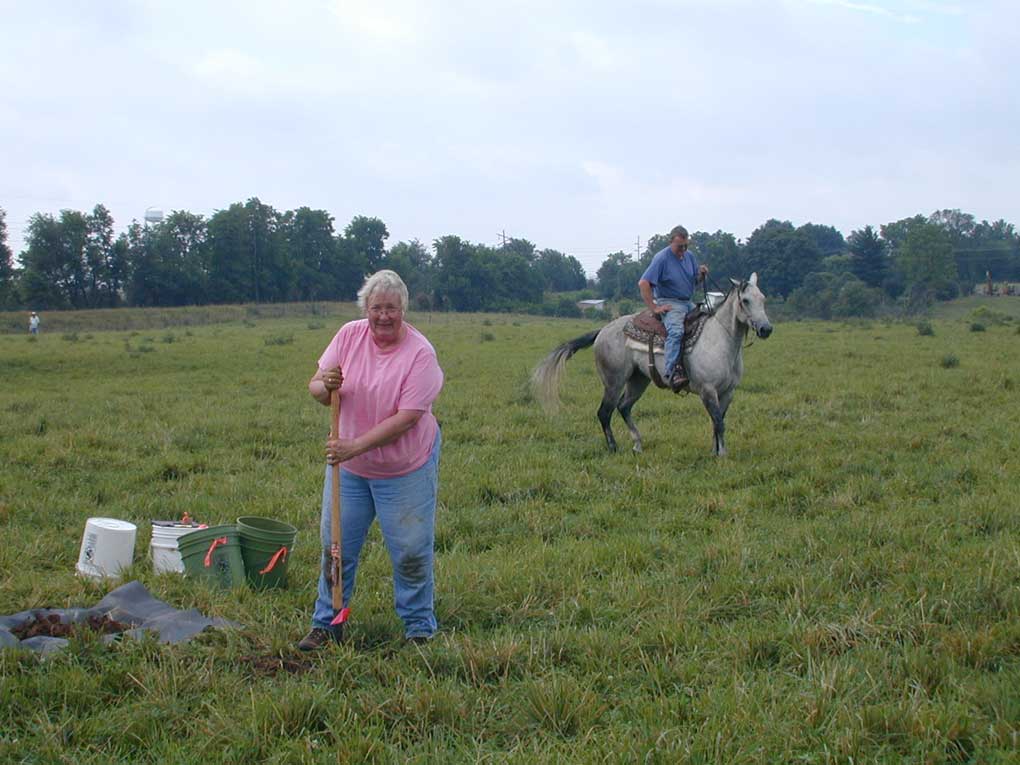
Cheryl Munson removes loose soil from the hole at N1000. Nearby, volunteer
worker Justin Hazuga scoops out the soil from the base of augered hole
N1000, E960.
After
cleaning the sides of the auger hole, soil characteristics and stratigraphic
relationships observed were documented and mapped on record forms; types
and relative amounts of materials observed were noted. The depth of cultural
materials and anthrosols was carefully checked. Screening took place over
the auger locations, so the holes could be efficiently backfilled.
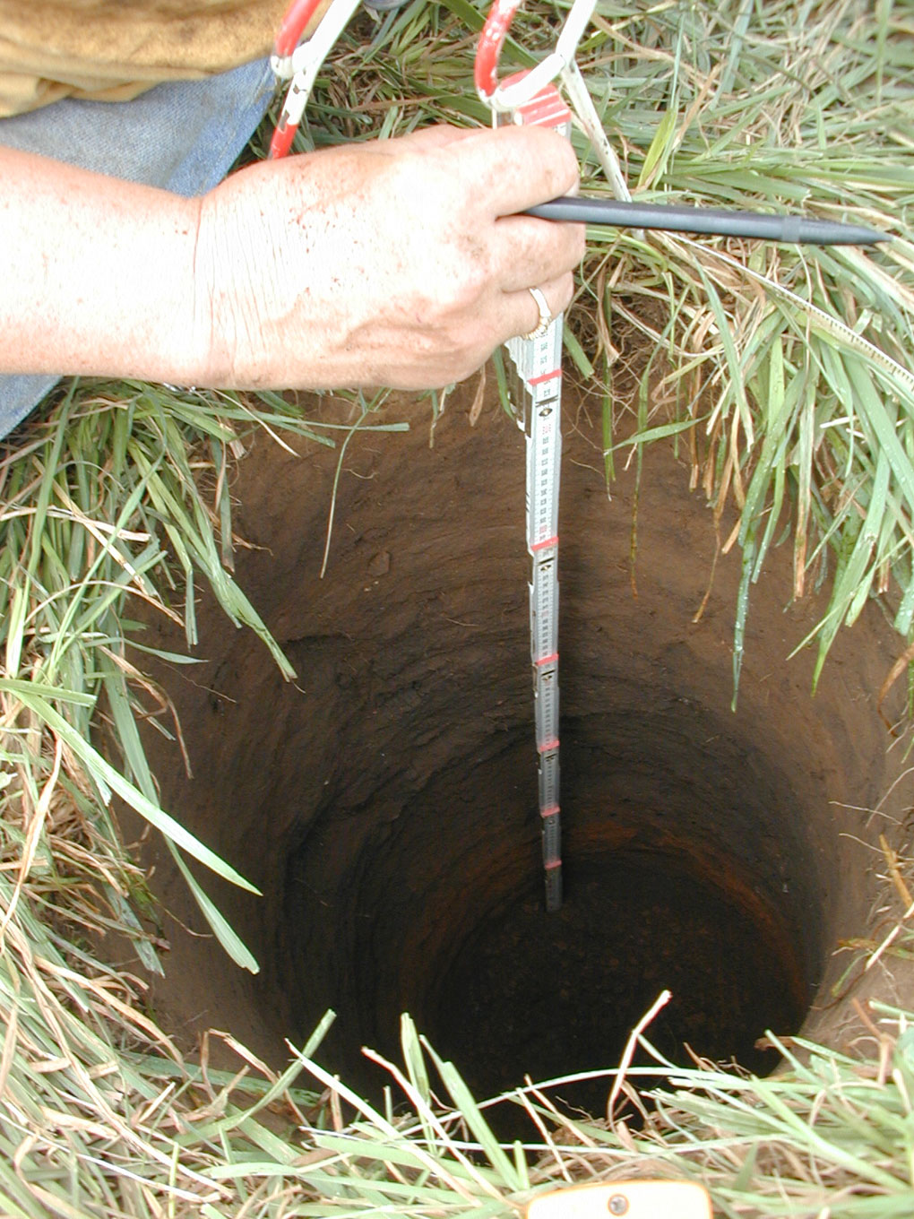
Clean auger hole at N980, E980, ready for soil description and mapping.
Cultural soils are homogeneous from the base of plowzone (0.30 m bs) to
0.80 m bs, and the deposit is probably pit fill – perhaps a refuse-filled
storage pit.
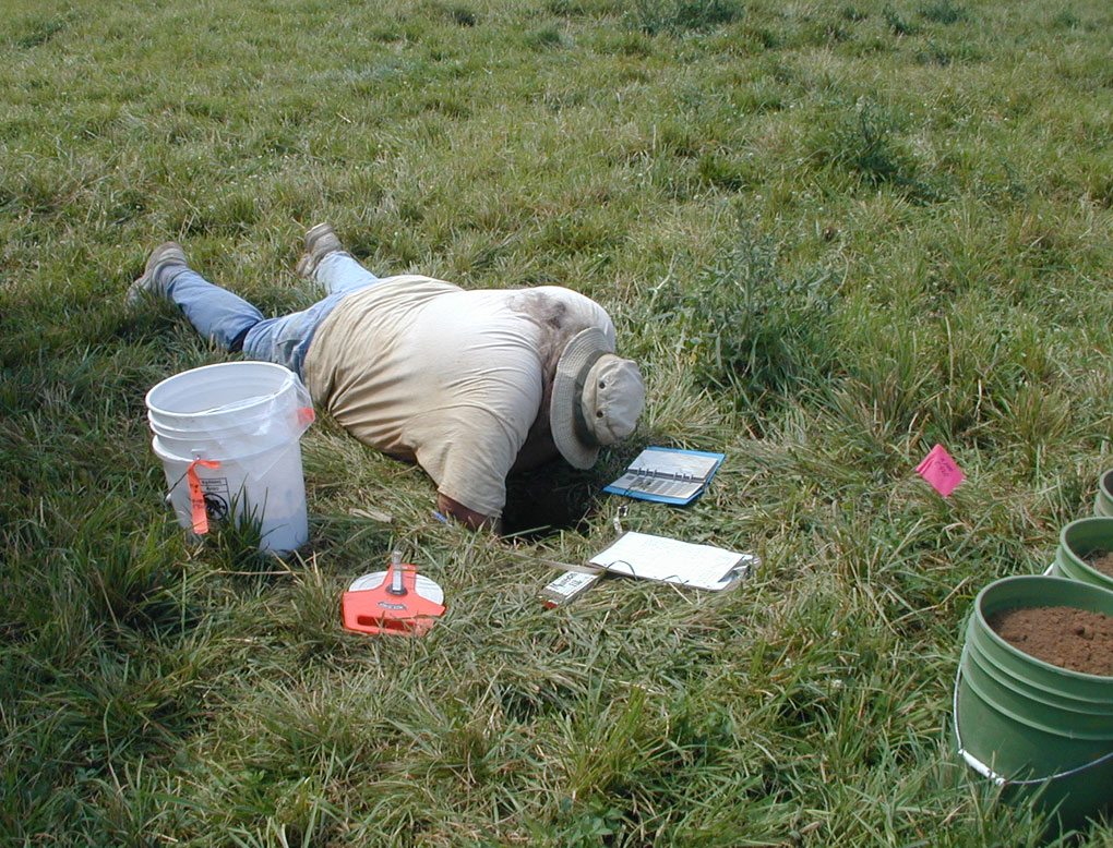
Bob McCullough recording soil profile of cleaned auger hole.