 |
|
CURRENT
RESEARCH |
|
VISITORS
& VOLUNTEERS |
| Co-Directors of the research project are Cheryl Ann Munson of Indiana Univeristy - Bloomington and Dr. Robert G. McCullough of IPFW. The project has received the generous support of: the landowner; professional archaeologists at many institutions in Indiana and Kentucky; the Falls of the Ohio Archaeological Society; regional historical organizations; and volunteers. |
|
|
|
Questions
or Comments?
|
|
Last
Updated 2.07.2004
|


Fall
2003 Work
Click on any picture for a larger version!
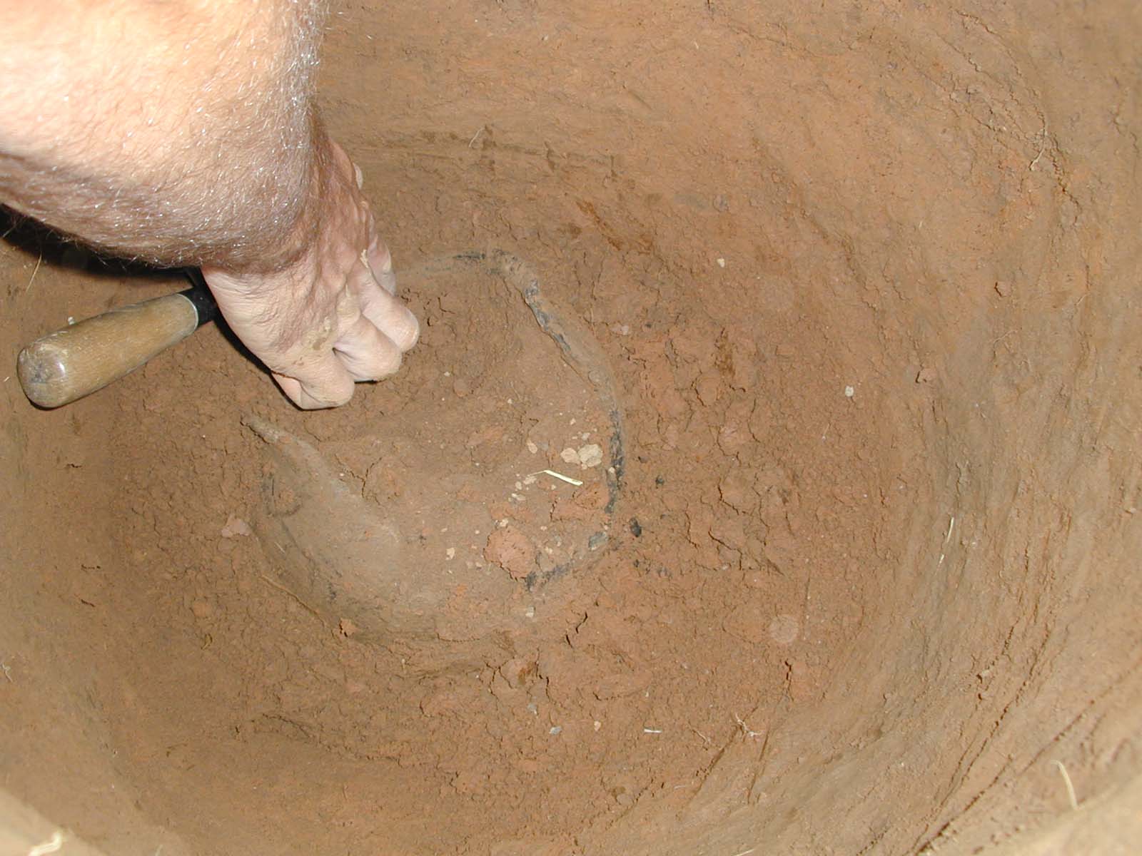
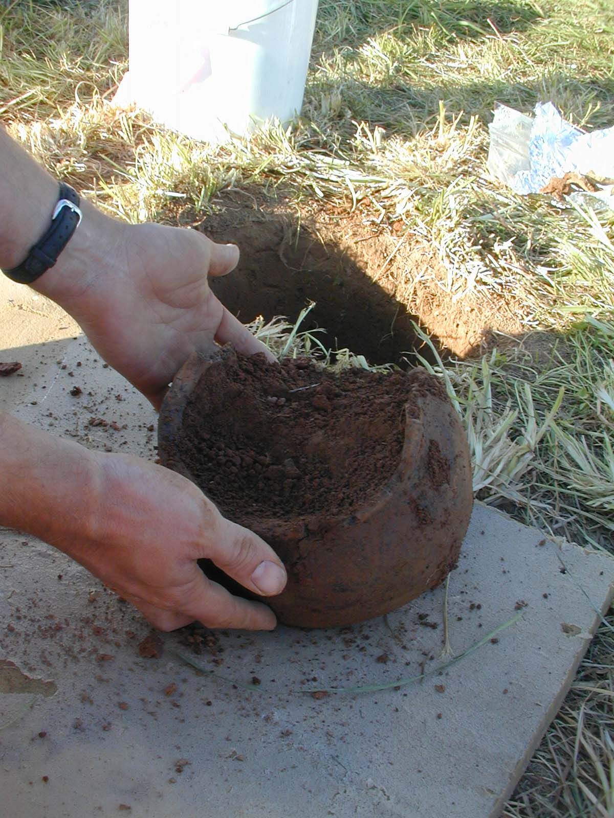
Andy White, the member of the crew with the longest arms,
did an excellent job of excavating the vessel.
Cheryl Munson and Bob McCullough debate the soil profile at N1080, E920,
and identify the limits of the feature containing the vessel.
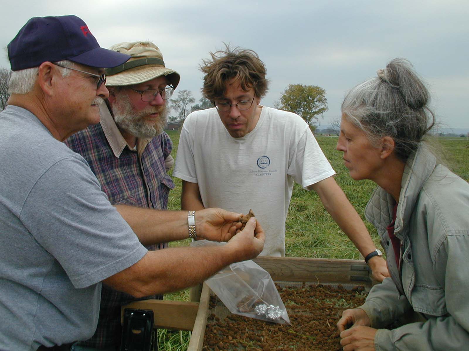
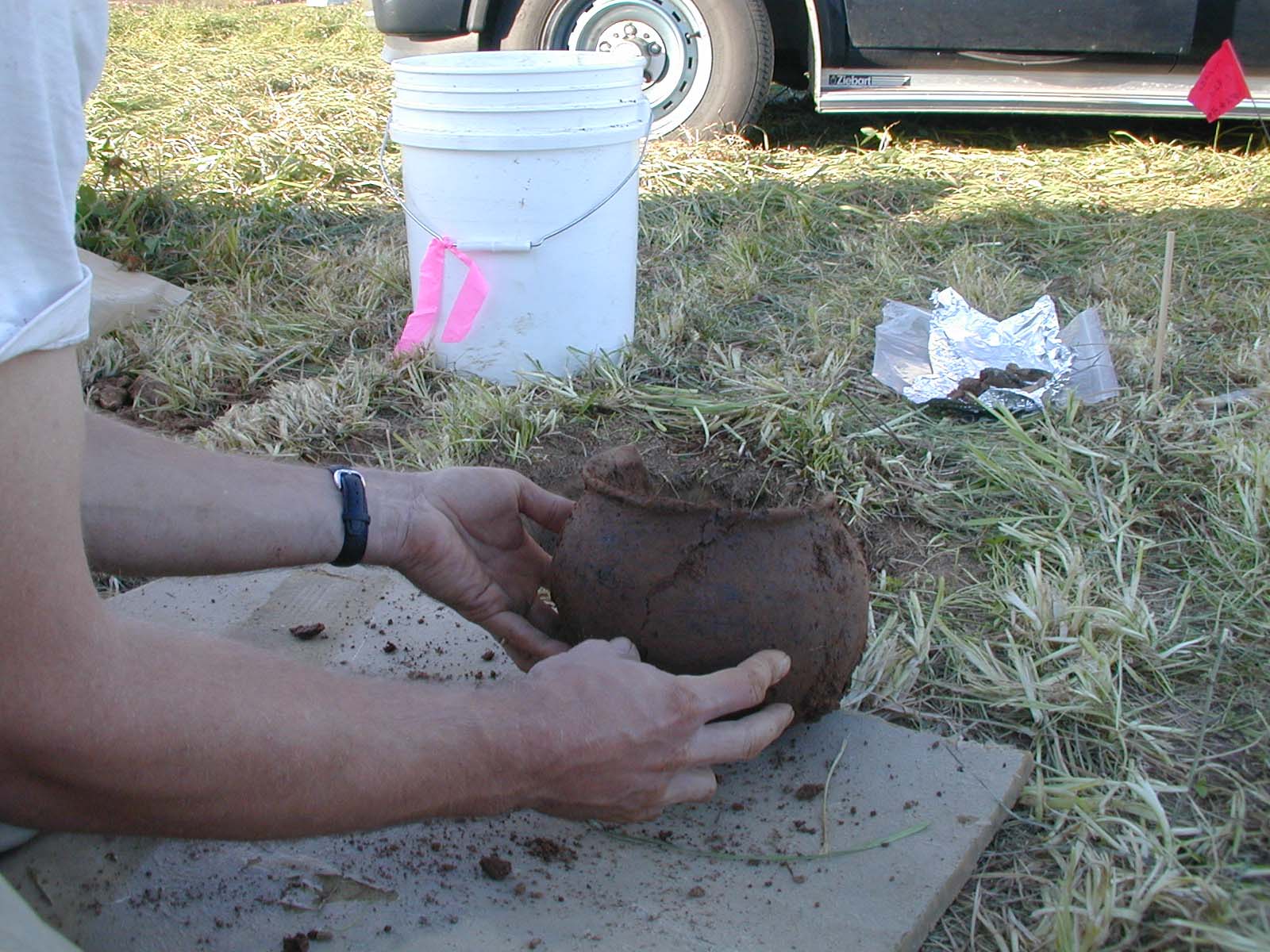
Mark Milliner, Bob McCullough, Andy White, and Sundae Murphy look at a
handle fragment recovered during screening of soil from N1080, E920. Does
it fit onto the jar, or is it from a separate vessel?

Volunteers Jim Allgood (FOAS) and Bett Etonohan (educator, Falls of the
Ohio State Park, and FOAS) screen sample from N940, E980,
collecting small pieces of charcoal in a foil packet.
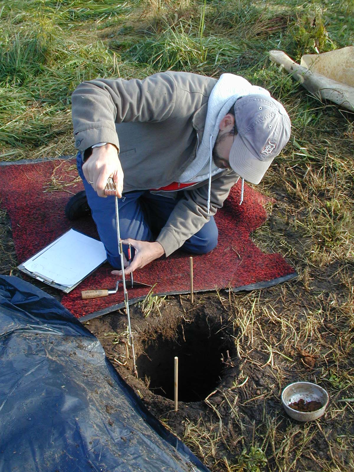
Archaeologist Mike Strezewski mapping soil profile at N940, E940 on the
possible southeast mound. This locale has been much disturbed by historic
construction, and the subsequent demolition of the buildings.
Brick was mound at 0.45 m below surface in this location.