 |
|
CURRENT
RESEARCH |
|
Learn
more about
Indiana Archaeology Month at Hovey Lake HERE! |
| Research
at the Hovey Lake site in 2003-2005 is supported by: a grant from
the Federal Highway Administration
(FHWA) under the Transportation Enhancement Program, Indiana
University, and private contributions. The Indiana
Department of Transportation (INDOT) administers the TE grant.
Also contributing to the research project are: Indiana Geological Survey, Indiana
University - Bloomington Department of Anthropology, the Indiana State Museum, University of Southern
Indiana, University of Evansville,
Indiana State University, and
community groups and volunteers. |

  IU-Bloomington Anthropology Dept. |
|
Last
Updated 9.6.2004
|
Excavation Update
|
From 1996-2001, Indiana University's test excavations focused on the residential area and the question of a central plaza. Test units explored portions of several houses and pit features. Testing also sampled two parts of the central plaza, where houses were not found. |
|
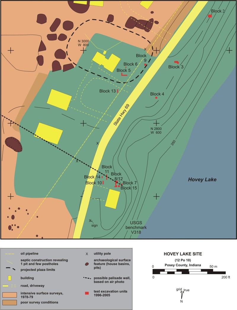 Map of the project area. |
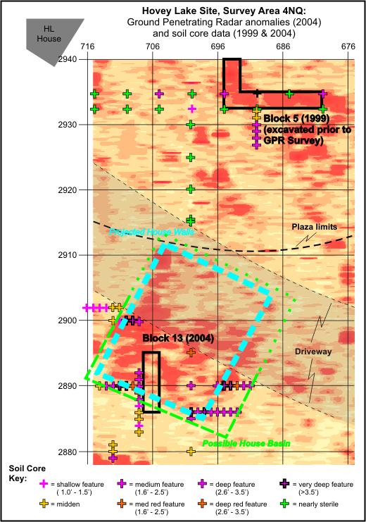 Ground Penetrating Radar image of edge of Central plaza |
|
Click images to enlarge. (Opens
in new window)
|
|
| In 2003-2005, research was designed to check whether a fortification wall surrounded the residential area of the village. A distinct soil stain seen in a 1953 aerial photo suggested both the central plaza and a palisade wall. Palisade walls were found at the earlier Mississippian Angel site, as well as many Mississippian towns, but were unknown for the large villages of the late Mississippian Caborn-Welborn culture. |
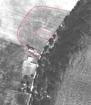 Aerial photo of site. Dotted lines indicate boundaries of central plaza, and probable location of fortification wall. |
| Ground Penetrating Radar (GPR) surveys across portions of the Hovey Lake site showed distinct anomalies that suggested houses as well as a possible palisade wall at the far southeast end of the village's residential area. | |
 |
|
 |
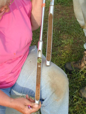
The first exploration below the surface involved 1-inch diameter soil cores. Test excavations in 2003-2004 uncovered portions of a prehistoric house, and beneath that wall features of a projecting bastion built onto the exterior of the palisade wall. |
 |
 |
|
Soil core near palisade, showing first and
second cores into a shallow house basin which has a burned floor.
|
|
| Like other Mississippian sites, bastions were probably placed at intervals along the main palisade wall. They would have held elevated platforms to help archers have a clear shot at any attacking enemies. The bastion walls must have been massive. They probably were about 16 feet tall, because they had building trenches more than 4 feet deep. The trenches held upright wooden posts placed about 1 foot apart. |
 Excavation map of rebuilt bastion. Click to enlarge. (Opens in new window) |
 |
|
|
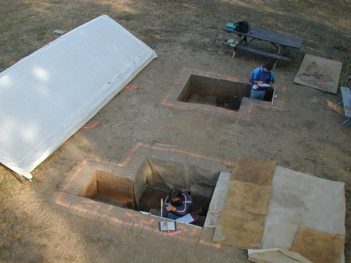
Excavation of house and pit features overlying
palisade and bastion wall trenches, Blocks 12 and 8,
Chad Ryan Thomas and Jonathon Criss. |
|
 Ground Penetrating Radar image of southeastern edge of site, with interpretive overlays. Click to enlarge. (Opens in new window) |
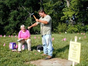
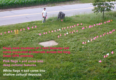
In 2005, additional soil cores were made to trace
the main palisade wall. These "micro-excavations" revealed
a series of deep cultural deposits that formed a line which coincided
with the long, linear GPR anomaly. The 2005 test units uncovered
portions of the main palisade wall and showed that one bastion was
rebuilt in approximately the same location, but encompassed a smaller
area. Also, a second house was found to have been built over the
ruins of the main palisade wall.
|
