 |
|
CURRENT
RESEARCH |
|
Learn
more about
Indiana Archaeology Month at Hovey Lake HERE! |
| Research
at the Hovey Lake site in 2003-2005 is supported by: a grant from
the Federal Highway Administration
(FHWA) under the Transportation Enhancement Program, Indiana
University, and private contributions. The Indiana
Department of Transportation (INDOT) administers the TE grant.
Also contributing to the research project are: Indiana Geological Survey, Indiana
University - Bloomington Department of Anthropology, the Indiana State Museum, University of Southern
Indiana, University of Evansville,
Indiana State University, and
community groups and volunteers. |

  IU-Bloomington Anthropology Dept. |
|
Last
Updated 9.6.2004
|
Geophysical Survey
In 2003
and 2004 we expanded our initial geophysical surveys, using both Ground
Penetrating Radar (GPR) and Soil Resistivity.
Ground Penetrating Radar
GPR surveys were carried out by the Indiana Geological Survey and the research team.
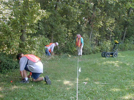
Measuring
and flagging the corners of a survey grid.
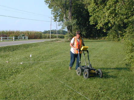
Jocelyn Turner
using the GPR instrument.
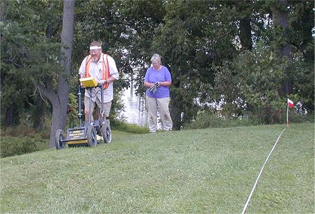
Dr.
Nelson Shaffer operating a GPR system
with Cheryl Munson recording the location of the pass.
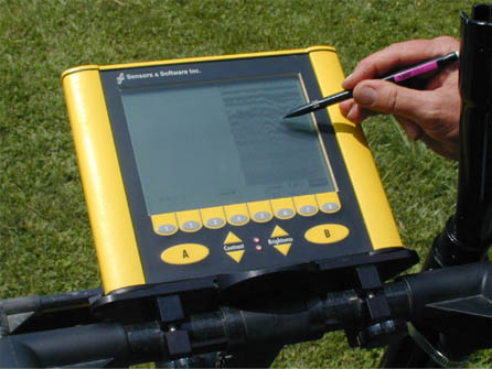
Close-up
of the GPR display screen showing an anomaly.
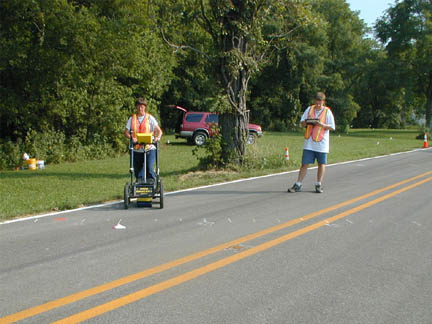
GPR
units can be used across surfaces other than bare or grass-covered lawns,
but we were unable to follow GPR anomalies from the roadside into the
area of the road bed.
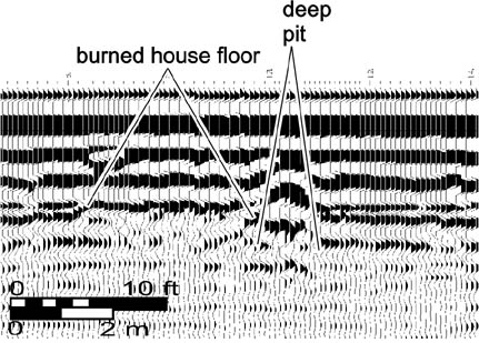
Results
like this (generated in 1999) allows the research team to identify
probable features and specific areas of the site that can be
effectively explored to answer research questions.