Bone Bank Archaeological Research
Posey County, Indiana
Rescue Excavations at the Bone Bank Archaeological Site in Southwestern Indiana
 Introduction
Indiana's First Archaeological Excavation
Survey and Testing
Significance
Project Goals
Research Stages
Expected Results
Bone Bank in 2000
Planning for 2001
Current Work
In the News
Fall 2001 Lecture
References
Geomorphological History
Links
Maps
Introduction
Indiana's First Archaeological Excavation
Survey and Testing
Significance
Project Goals
Research Stages
Expected Results
Bone Bank in 2000
Planning for 2001
Current Work
In the News
Fall 2001 Lecture
References
Geomorphological History
Links
Maps
SURVEY AND TESTING
Surveys in 1997-1999 demonstrated that most erosion takes place by bank cutting, and by trees being washed out during high water, followed by slumping along the washouts.
Surveys (Munson 1997, 2000, 2001) along the exposed river bank, combined with reconstruction of the geomorphic history of the locale, show that the village site was located on the crest of a ridge that formed as a low Pleistocene terrace. The elevation of the ridge crest is above most floods, which would have been important to the villagers. Systematic examination of the eroding bank has identified cultural deposits within the upper soils of very small remnant of terrace, as well as adjacent side slopes and low areas that bordered the ridge crest. In situ artifacts in the bank extend for a north-south distance of 285 m. Despite the great length of the deposits, cores suggest that the deposits extend back into the bank for probably less than 20 m in most areas.
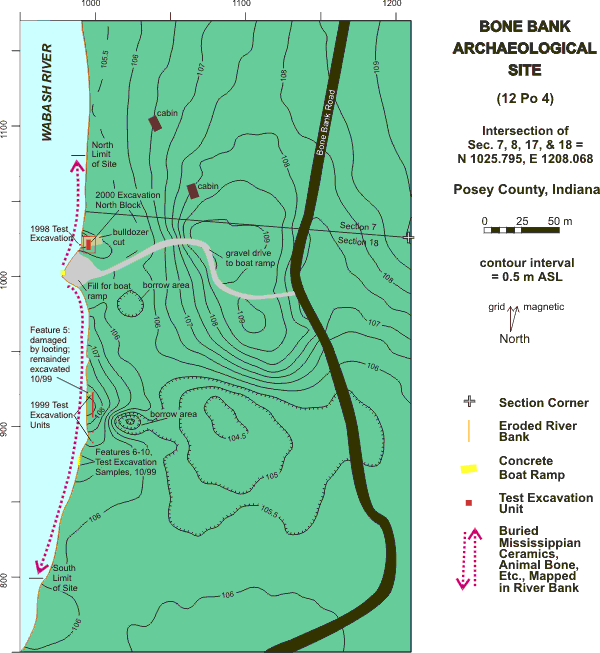
Topography of the Bone Bank site, showing site limits based on river bank survey and 1998 and 1999 test excavation units (updated fall 2000 and spring 2001, to show the North Block excavation and additional mapping on the east and south).
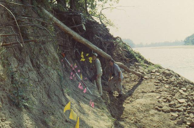
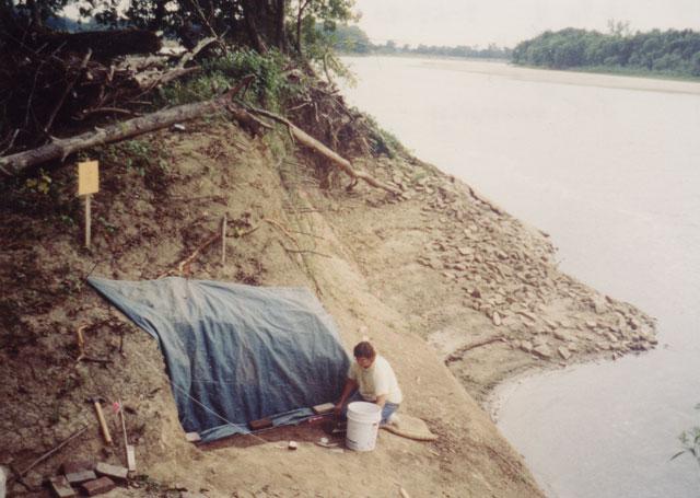
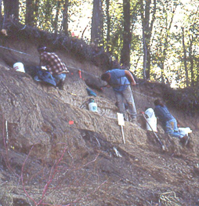
Survey of the river bank at the north end of the Bone Bank site, during an ususually low water stage. When doing survey, the bank is carefully searched for artifacts and each location is marked with a flag.
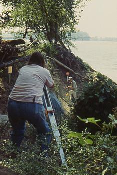
Jocelyn Turner and Patrick Munson mapping artifacts found during survey of the river bank. (The total station is set up over a known location on the grid. When the instrument is both positioned and leveled, it can then be used to measure location points. A total station is use to map artifact locations according to the site grid, which is referenced to permanent markers. The red and white rod is topped by a prism which is the target for the laser beam emitted by the total station [transit]. When the rod is completely vertical [indicated by a bubble level], the total station will accurately record the horizontal and vertical location of the artifact.)
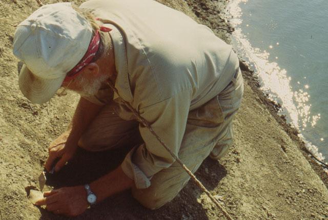
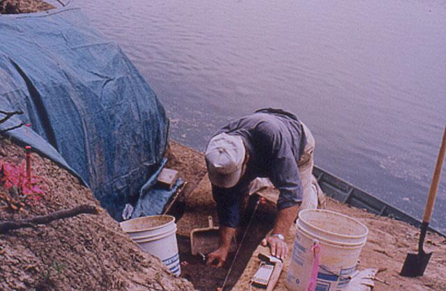
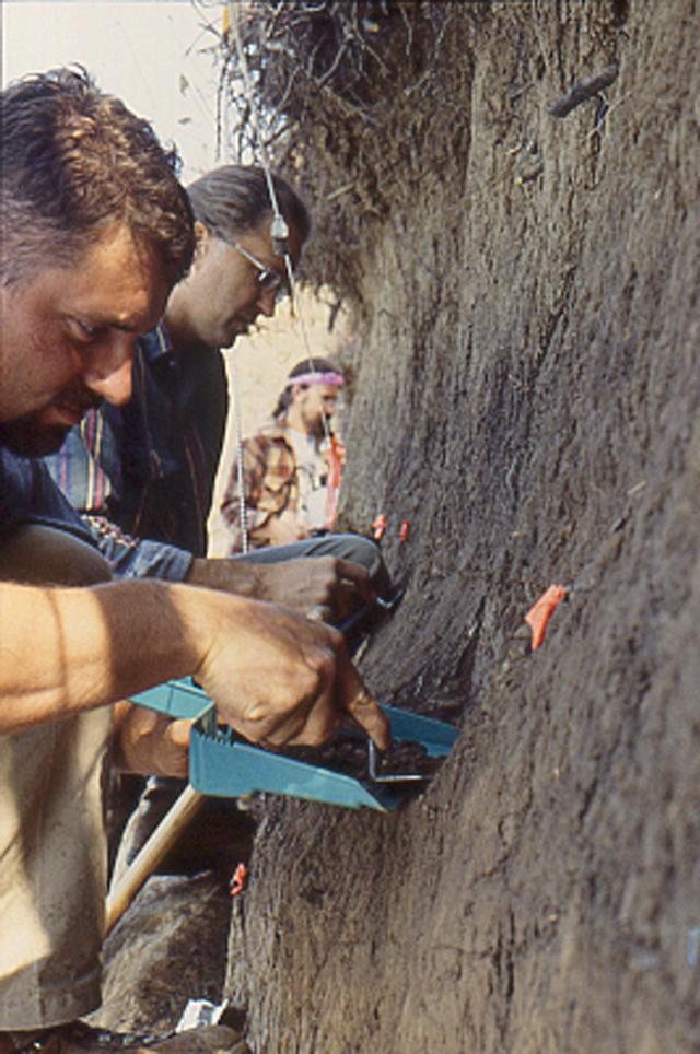
Patrick Munson collecting an artifact from the river bank. After mapping, artifacts are bagged individually and then logged into the Field Specimen Log.
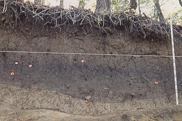
Profile of the natural and cultural deposits at Bone Bank. Note that the vertical scale is exaggerated.
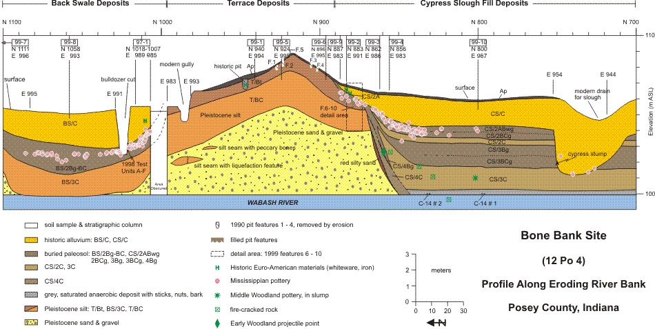
The first systematic archaeological excavation at Bone Bank, and the first excavations since Lesueur’s work in 1828, was accomplished in 1998; additional testing was carried out in 1999 (Munson 2000). This work involved a series of small-scale test excavation units, which together encompassed only 18.5 square meters. Nonetheless, it revealed that the midden materials are typical of household refuse deposits -- broken pottery, animal bones, cooking stones, and broken stone tools. When the villagers lived at the site, they discarded refuse by dumping materials down slope on the east and south sides of the ridge crest, toward the slough which ran at the bottom of the ridge. Some time after the Caborn-Welborn people left, the cultural deposits on the slopes became covered by many layers of river silt, 0.50-2.5 m in thickness. On the slopes of the ridge, the silt has "buried" the midden deposits and protected them from surface effects (such as the former farming activities).
Initial work in test excavation Units A, and B, on the riverbank at the north end of the site, 1998.
Jocelyn Turner, beginning excavation in Test Units A to F, on the riverbank, 1998.
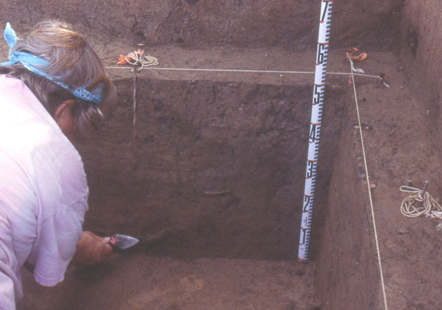
Cheryl Munson pointing to sherds in the wall profile of test Unit C, 1998.
The river bank surveys also revealed preserved pit features, representing cooking pits on the slopes of the terrace ridge and storage pits on the crest of the ridge (Munson 2000). Small samples from exposed pits were excavated in 1999. The pits also contained discarded tools, pottery fragments, and food remains. Charcoal, suitable for radiocarbon dating, is present in both the midden deposits and pit features.
Buried midden and shallow pit feature containing pottery sherds and cracked rock, south end of the site, looking east, 1999.
Test excavation at exposed pit features at the south part of the site, near the filled in lake at Cypress Slough, 1999. Rex Garniewicz, John Piper, and Staffan Peterson excavating.
Piper, Peterson, and Garniewicz excavating samples from pit features, 1999.
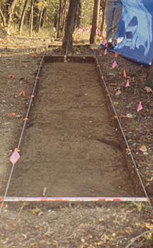
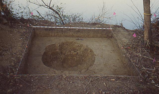
Excavation of test units, contiguous 1-meter squares on the terrace ridge crest, 1999.
Excavation of Feature 5, in progress showing profile of deposits, terrace ridge crest, 1999.
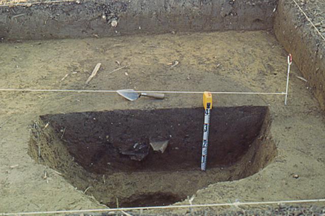
Feature 5, excavation completed.
In short, the Bone Bank site still has archaeological deposits that can tell us much about the Caborn-Welborn culture and the lives of the Native American villagers who lived along the Wabash about 300-600 years ago. The site continues to erode, and only a small fraction of the village deposits remain. The river’s course cannot be stopped. The only alternative to losing what little has survived at this site is a rescue excavation.
Return to Top
Last updated on 8/06/2001
Send Comments to: munsonc@indiana.edu
Site sponsored by Indiana University