Bone Bank Archaeological Research
Posey County, Indiana
Rescue Excavations at the Bone Bank Archaeological Site in Southwestern Indiana
 Introduction
Indiana's First Archaeological Excavation
Survey and Testing
Significance
Project Goals
Research Stages
Expected Results
Bone Bank in 2000
Planning for 2001
Current Work
In the News
Fall 2001 Lecture
References
Geomorphological History
Links
Maps
Introduction
Indiana's First Archaeological Excavation
Survey and Testing
Significance
Project Goals
Research Stages
Expected Results
Bone Bank in 2000
Planning for 2001
Current Work
In the News
Fall 2001 Lecture
References
Geomorphological History
Links
Maps
PLANNING FOR 2001 EXCAVATIONS, SOIL CORES AND MAPPING
In an effort to map the buried culture-bearing zones in the south part of the site in three dimensions, we collected a series of solid earth soil cores in fall 2000 to quantify cultural materials -- ceramics, rock, chert flakes, daub, charcoal, animal bone -- by location and depth. Information about the distribution, depth, density, and type of cultural materials will guide our selection of the best area for the South Block excavations in Fall 2001. A similar procedure has proven effective in a number of buried archaeological contexts (Stafford 1995). The Indiana Geological Survey contributed equipment and personnel to extract the soil cores.
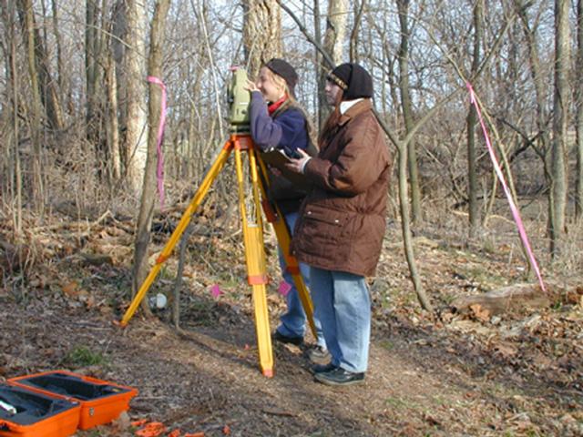
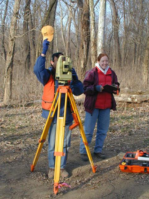
Prior to excavations in Fall 2001, we also made a detailed topographic map [( Survey and Testing ] to record elevations and expanded our previously limited coverage. Mapping at Bone Bank has been a challenge because of the thick forest cover. In the early spring, when vegetation is most sparse, high river levels have limited mapping in most years. We got lucky in March 2001! No leaves, and dry ground. Faculty and students from the University of Evansville helped with the mapping.
Below is a sampling of photos from our work.
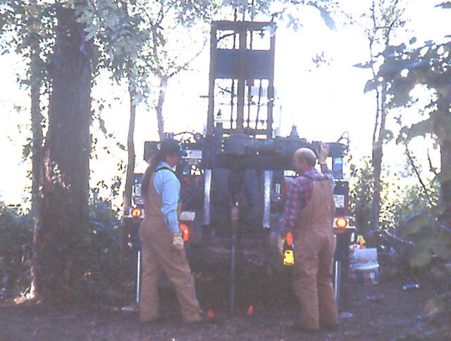
Jay Arnold and Leonard Middleton use the Indiana Geological Survey drill rig to extract soil cores. A set of four 2-inch soil cores were drilled at selected grid locations to 1 to 3 meters below surface. Four cores would provide approximately 1000 grams of soil in each 10 cm-level.
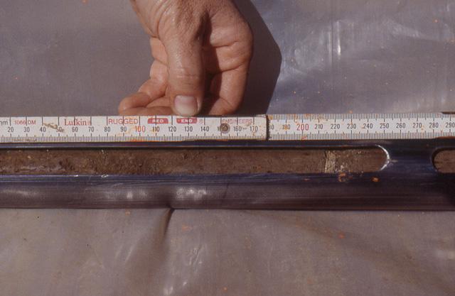
Marking 2-inch soil in 10-cm increments.
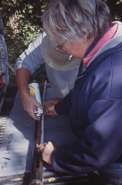
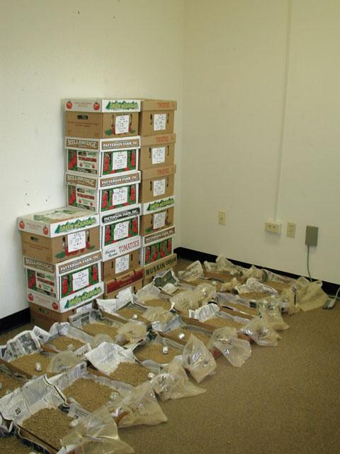
Each 10-cm section of the core is cut from the coring tube and placed in a bag labeled according to grid location and depth below surface.
Mississippian pottery sherd (shell tempered) in soil core at 22 cm below the 1 m level.
Most artifacts recovered in coring were smaller than 1/4 inch.
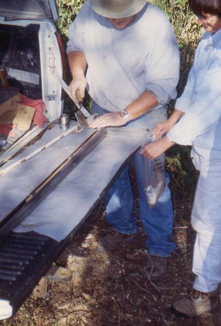
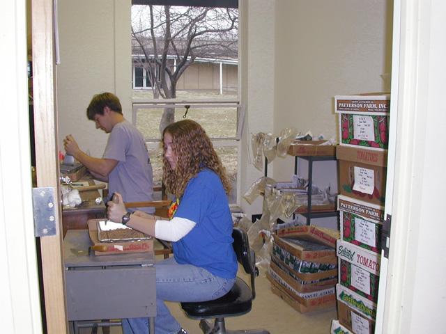
Lab work at IU. Paul Stumpner and Carly Borgmeier preparing soil cores for drying.
Soil core samples are air-dried to help the soil break down and disolve.
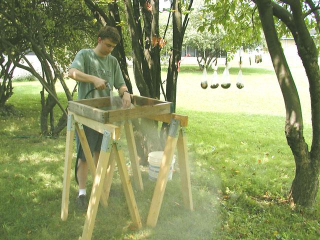
After drying, soil samples are placed in fine mesh bags for soaking and disolving the soil. Sean O'Brian uses a hose to wash the dissolved soil from the artifacts and natural and cultural residues inside the bag. (Four bags of cultural material hang on a line to dry.)
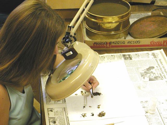
Dried soil samples are sieved through 1-mm and 2-mm meshes to size grade the samples. The 2-mm fraction was sorted into natural and cultural materials The 1-mm fraction was visually scanned to see if there were any types of materials not observed in the 2-mm mesh. Stephanie Kazmierzak using a magnifying light to sort materials.
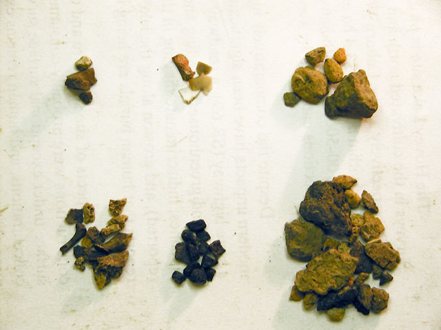
Sorted materials from N870 E995, 120-130 cm below surface. Natural materials are in the column at the left, next to the small pliers: from top, manganese pellets, pebbles, and roots. Cultural materials are in the center and left columns.
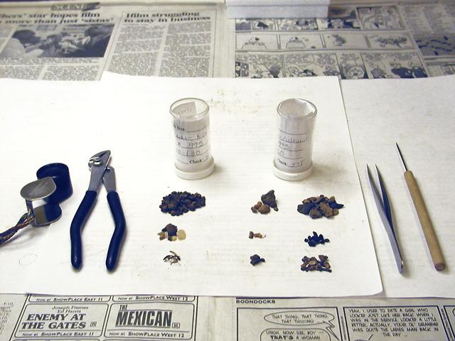
Cultural materials sorted from soil sample N870 E995, 120-130 cm. Left column, from top: daub, chert flakes, and rock fragments. Right column: sherds, charcoal, bone fragments.
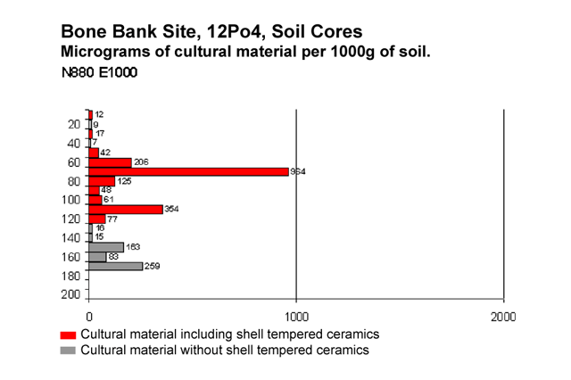
Graph showing weights (micrograms, up to a maximum of 2000) of culturals materials by depth (cm below surface) at N800 E1000, standard to 1000 grams of soil sample. Red indicates levels containing shell tempered (Mississippian) ceramics. Gray indicates cultural materials with no shell tempered ceramics.
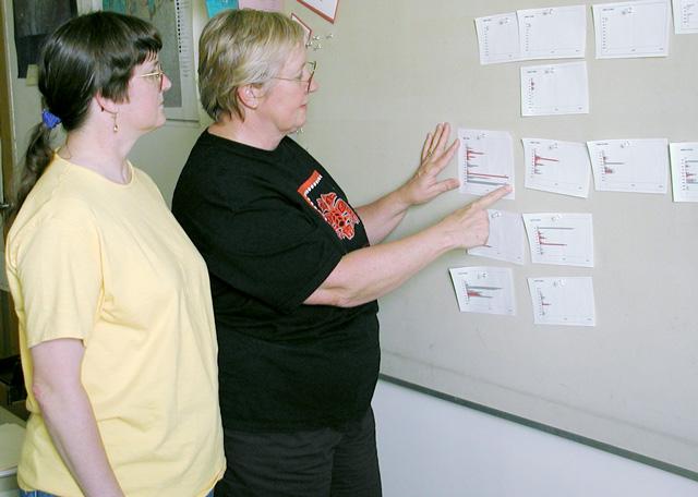
Jocelyn Turner and Cheryl Munson comparing the graphed soil core results.
University of Evansville students, Rachel Herzberg and Jennifer Malcom, use a total station to measure elevations for topographic mapping.
Professor Mark Valenzuela and archaeology student Rachel Debold, University of Evansivlle, map the position of the riverbank. In places, a brief period of high water in early winter of 2001 cut back the bank a much as 2 meters.
Return to Top
Last updated on 8/06/2001
Send Comments to: munsonc@indiana.edu
Site sponsored by Indiana University