Bone Bank Archaeological Research
Posey County, Indiana
Rescue Excavations at the Bone Bank Archaeological Site in Southwestern Indiana
 Introduction
Indiana's First Archaeological Excavation
Survey and Testing
Significance
Project Goals
Research Stages
Expected Results
Bone Bank in 2000
Planning for 2001
Current Work
In the News
Fall 2001 Lecture
References
Geomorphological History
Links
Maps
Introduction
Indiana's First Archaeological Excavation
Survey and Testing
Significance
Project Goals
Research Stages
Expected Results
Bone Bank in 2000
Planning for 2001
Current Work
In the News
Fall 2001 Lecture
References
Geomorphological History
Links
Maps
RESEARCH STAGES
The rescue excavation project is predicated on two key points: (1) erosion along the river bank at the Bone Bank site has continued unchecked, and now very little of the archaeological deposits survive -- perhaps only 2-3%; and (2) there is no practical way to "hold back" the river from its meandering course.
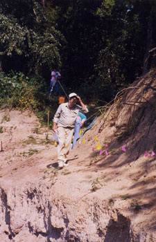
Survey along the eroding river bank, Patrick J. Munson, looking north. Flags mark the location of artifacts, which in this particular area are nearly 2 meters below the present ground surface.
The excavation project at Bone Bank is Indiana's first state-funded rescue excavation. It is funded by a grant from the Wabash River Heritage Corridor Program, and matching funds and services from private sources, academic institutions, and research organizations.
Four Rivers Resource, Conservation, and Development Area, Inc., Peterburgh, Indiana (Mr. David Elgin, 812-354-6808) is a not-for-profit organization that serves the 10-county area of southwestern Indiana. They will be the administrative unit for the Rescue Excavation project.
Cheryl Ann Munson, Department of Anthropology, Indiana University, Bloomington, is the project director, and will contribute time to meet the matching share.
Other professional researchers will contribute part of their time to assist the project: Dr. Patrick J. Munson, Department of Anthropology, Indiana University, Bloomington; and Ms. Marjorie Jones, Antropologist with Department of Social Sciences, University of Southern Indiana, Evansville.
The Indiana Geological Survey is assisting the project by providing equipment and personnel to drill soil cores, and equipment for artifact cleaning and analysis.
Indiana State University and the Glenn A. Black Laboratory of Archaeology are loaning equipment to help with the excavation.
University of Evansville will assist with exapanded topographic mapping.
HLFWA will assist the project by providing storage space and a communications center, since Bone Bank is in a remote area for cell phones.
Special thanks to the Robert Lee Blaffer Trust and the Gray Family Trust for financial assistance to meet the matching fund requirements.
The Rescue Excavation project involves multi-stage excavations and laboratory work that will be carried out over the course of about 21 months, with field work beginning in September 2000. The first field season in fall 2000 will be followed by a period of laboratory analysis to assess results and plan particular excavation areas for the second field season. The second field season will take place in summer to fall 2001, to complete the excavation. Laboratory work will follow the second field season, with analysis and reporting completed by June 2002.
Stage 1: Fall 2000 - Remove vegetation to carry out the North Block excavation and drilling of soil cores. Excavate a block of 1-m square units in the priority 1 northern part of the site, where a buried midden is present and bank erosion is greatest. Collect geological and archaeological data for the priority 2 area in the central and southern part of the site by means of solid earth cores to map subsurface cultural zones. The Indiana Geological Survey will drill the cores for archaeologists to analyze.
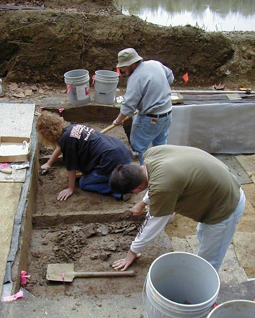
Excavation of 1-meter units, Kris Suthers, Trish Word, and Jeff Brown, fall 2000. See more 2000 excavation photographs here.
Stage 2: Fall 2001 - Specific areas for excavation in the central and southern part of the site will be identified once the coring results of Stage 1 are analyzed with respect to preservation and density of materials and features. Two types of excavation are planned. First, the plow zone and recent alluvium in the shallow terrace deposits will be removed with heavy equipment to expose features for excavation. Trenching will include a series of parallel east-west trenches excavated at intervals across the terrace deposits to intersect possible stockade features which should have a north-south trend in this locale, if they are present. Second, additional block excavations will be carried out to document buried middens and pit features on the south slope of the site, adjacent the former lake at Cypress Slough. With the depth and east-west dip of the buried cultural zone known from soil cores, a backhoe can safely be used to remove the culturally sterile overburden from the excavation blocks.
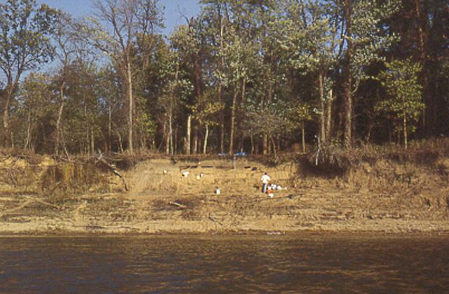
Buried pit features, on the bank of the now filled-in backawater lake at Cypress Slough. Looking east, fall 1999 test excavations.
Field investigations will follow the already established site grid and expand the topographic mapping to the south and east. Multiple bench marks will be established to allow us to maintain vertical and horizontal control, even if the site is flooded in the spring between Stages 1 and 2. Flooding is common in late winter-early spring, and sometimes occurs in the summer. High water levels have limited previous testing to September and later. Unit and feature excavation will be primarily by hand tools (trowels and shovels, as appropriate) and employ screening of excavated cultural soils through 1/4-inch screen, using pumps and large hoses. However, backhoes will be used to remove overburden and plow-disturbed soils. Flotation samples will be collected from cultural deposits for processing, either on site or at the workshop at the nearby Hovey Lake Fish and Wildlife Area. Field documentation will use the same types of record forms, plan maps, profiles, and soil descriptions employed during test excavations (Munson 2000).
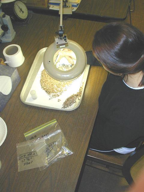
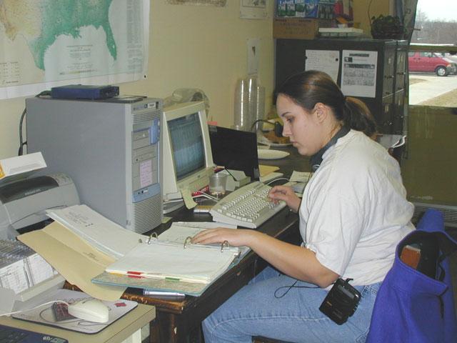
Rebecca Sick sorting flotation samples in the lab, January 2001.
Laboratory work will follow each stage of field work, with the tasks being the cleaning, identification, and cataloging of recovered materials, and integration of field records and lab records. In addition, selected plan maps and profiles will be selected for illustration. The work during the first laboratory stage will include analysis stratigraphic and preservation characteristics of the soil cores, in order to design the excavation plan for the second stage. The final laboratory stage will be the most substantial. Samples will be selected for radiocarbon dating, as well as floral and faunal analysis. Similarly, samples will be selected for analysis of ceramics, lithics, and other recovered materials. Collections will be prepared for permanent curation which will be provided by the University of Southern Indiana. Anthropologist Marjorie Jones has will supervise the work involved in putting the collection into curation in the USI system.
Laurie Michnal organizing catalog records in the lab, February 2001.
Return to Top
Last updated on 8/06/2001
Send Comments to: munsonc@indiana.edu
Site sponsored by Indiana University